Turning Raw Drone Imagery into Client-Ready Assets
When a drone returns from a flight, it carries hundreds of individual images. Each one is a raw capture, high-resolution, but flat, unaligned, and full of the camera's own corrections. Handing those raw files to a client rarely tells the story the data deserves. The real value appears only after those images have been assembled, corrected, and organised into what the industry calls processed drone deliverables.
Processed deliverables are the finished products that come from raw aerial data. They are orthomosaics, 3D models, elevation maps, and annotated layers that let a viewer measure, compare, and understand a site without visiting it. For surveyors, construction managers, agricultural consultants, and infrastructure inspectors, these are the files that feed into reports, CAD software, and client presentations. Raw photos alone cannot do that.
What Counts as a Processed Deliverable
The term covers several distinct outputs, each suited to a different use case. Knowing which one a project needs is the first step in turning flight data into something useful.
- Orthomosaic: A geometrically corrected, stitched-together image of the entire area, where every pixel maps to a real-world coordinate. You can measure distances, areas, and volumes directly from it.
- Digital Surface Model (DSM): A raster that records the height of the tallest feature at each point, treetops, buildings, the ground. Useful for line-of-sight analysis and flood modelling.
- Digital Terrain Model (DTM): Like a DSM but with vegetation and structures stripped away to show the bare ground. Essential for earthworks calculations and drainage planning.
- Point Cloud: A dense set of 3D points produced by photogrammetry or LiDAR. It can be rotated, measured, and imported into CAD or BIM software.
- Annotated Map or Report: A final presentation layer that overlays measurements, annotations, and colour ramps onto the ortho or model, ready for a non-technical audience.
Each deliverable requires a different processing workflow, and the quality of the raw capture, overlap, lighting, GPS accuracy, directly limits what the finished product can show. That relationship between capture and output is where the skill lies.
How Raw Photos Become Processed Data
The journey from a memory card full of JPEGs or DNGs to a client-ready file involves several stages. Aerial processing software handles most of the heavy lifting, but the operator makes critical decisions at each step.
1. Import and Quality Check
Before any stitching begins, every image gets checked for blur, exposure errors, and dropped GPS tags. A single blurred frame in a critical area can produce a smeared seam in the orthomosaic. Most processing pipelines flag low-quality images automatically, but a manual review catches issues the algorithms miss, such as lens flare or dust spots that shift between frames.
2. Alignment and Georeferencing
Raw images are shot from slightly different angles and positions. The software finds common points between overlapping frames and aligns them into a single coherent geometry. If the drone's onboard GPS was accurate enough, the alignment can be fully automatic. In areas with poor satellite reception or heavy tree cover, ground control points, visible markers placed before the flight, are needed to anchor the model to real-world coordinates.
3. Point Cloud Generation
From the aligned images, the software calculates the 3D position of every visible point. This step produces the point cloud, which is the foundation for both the orthomosaic and the elevation models. The density of the point cloud depends on the image overlap and the resolution of the camera. Higher overlap means more points, which means finer detail in the final model but also longer processing time.
4. Orthorectification and Mosaic Stitching
Each image is corrected for lens distortion and perspective, then projected onto the ground plane. The corrected images are blended together into a seamless orthomosaic. Blending algorithms handle colour differences between frames, but inconsistent lighting across the flight, for example, clouds moving through during the mission, can still produce visible seams. Careful flight planning and consistent overcast light reduce this problem.
5. Elevation Model Extraction
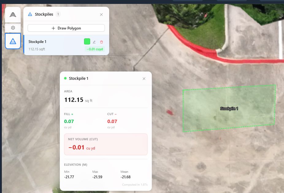
From the point cloud, the software can generate a DSM and, with additional filtering, a DTM. The DTM requires classification to separate ground points from vegetation and structures. That classification is never perfect; in dense forest the ground surface can only be interpolated. Understanding those limitations is important when using the model for cut-and-fill calculations.
6. Final Export and Formatting
Processed deliverables are exported in formats that match the client's workflow. Common options include GeoTIFF for orthos and elevation rasters, LAS or LAZ for point clouds, and PDF or web maps for reports. Each format carries its own coordinate system, resolution, and compression settings. Delivering in the wrong projection or resolution renders the data unusable for the recipient.
What Processing Reveals, and What It Hides
Processed data looks authoritative, but it is always an interpretation of the raw captures. Every step from alignment to classification introduces assumptions. A DSM that shows a building's roof also shows the tree beside it as a single merged lump if the point density was too low. A DTM that claims to show bare ground under a forest is an educated guess, not a measurement.
The best processed deliverables come with metadata that documents those assumptions: the overlap percentage, the number of ground control points, the RMS error of the alignment, and the date and time of capture. Without that context, a client might treat a smoothed DTM as survey-grade when it was actually derived from a quick reconnaissance flight.
Workflows for Different Sectors
Processed deliverables are not one-size-fits-all. A construction site manager needs a different product than an environmental consultant.
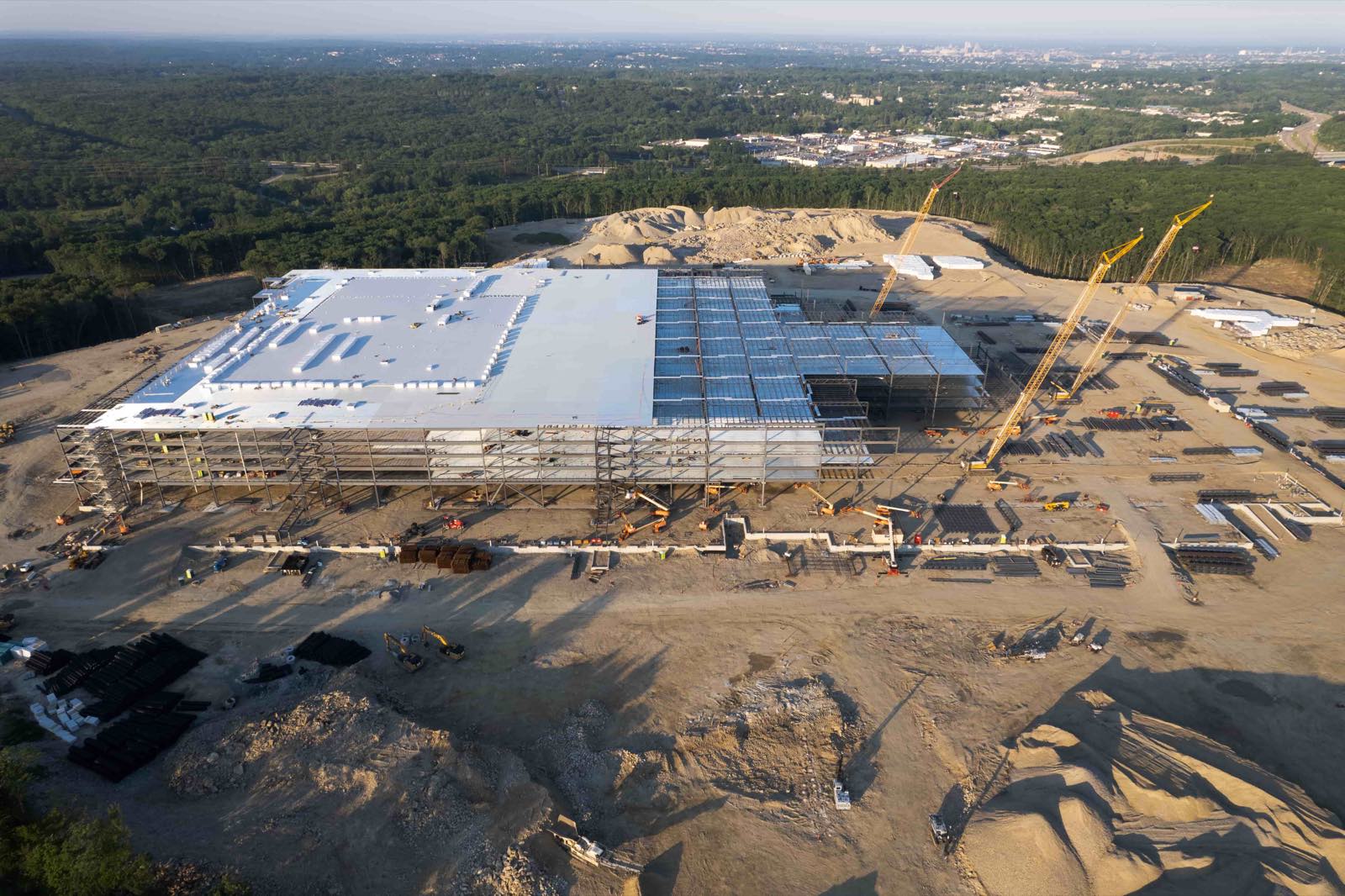
Construction and earthworks rely on DTMs for volume calculations. The workflow typically requires high overlap (80% front and side), ground control points, and careful flight timing to avoid shadows that confuse the classification algorithm. Deliverables are often delivered in a CAD-native format with a coordinate system matching the local survey grid.
Agriculture uses orthomosaics and multispectral indices such as NDVI. The raw captures must be radiometrically calibrated so that the indices are comparable across flights. Processed deliverables here are often time-series maps that show crop health changes over a season.
Infrastructure inspection demands high-resolution orthos and 3D models that can be zoomed into without losing detail. The processing pipeline needs to handle oblique images captured from close range, which requires different alignment algorithms than nadir-only flights.
Environmental monitoring uses DSMs and orthos to track erosion, vegetation change, or water boundaries. The value is in consistent repeatability, the processing must produce outputs that can be compared year to year, which means using the same projection, resolution, and classification settings every time.
Getting from Capture to Client with Less Friction
For many organisations, the processing step is the bottleneck. The drone pilot finishes the flight in an hour, but stitching and classifying the data takes the rest of the day, or longer if the software is unfamiliar or the computer is underpowered. Some projects require specialised processing that the in-house team cannot handle, such as combining thermal and visible imagery or producing a true orthophoto with a DTM.
This is where a dedicated data processing service changes the equation. The National Drone Services aerial imagery platform handles the entire processing pipeline, from raw upload to final deliverable, using consistent, repeatable workflows. The operator uploads the flight data, sets the desired output type and resolution, and receives the finished files without needing to learn photogrammetry software or manage a render queue.
The platform also organises and visualises the data, making it easy to compare different flights, add measurements, and share results with stakeholders. For a project manager juggling multiple sites, having all processed deliverables in one accessible location reduces the back-and-forth that usually follows a drone flight.
Using a platform like the National Drone Services aerial imagery platform means the processing step does not become the bottleneck. The pilot stays in the field capturing more data, and the client receives exactly the format they need without extra rounds of re-exporting or reformatting.
Choosing the Right Processed Deliverable for Your Project
Not every job needs a full 3D point cloud. An orthomosaic with a simple elevation overlay might be enough for a site overview, while a detailed DTM is essential for earthworks planning. The choice depends on what decisions the data will support.
- For visual inspection and reporting, a high-resolution orthomosaic with annotations.
- For volume and cut-and-fill calculations, a DTM with known accuracy and ground control.
- For structural or vegetation analysis, a DSM and point cloud with sufficient density to resolve individual features.
- For time-series comparison, orthos and elevation models processed with identical parameters across all flights.
The key is to define the deliverable before the flight. A flight planned for orthomosaic generation will not produce a good DTM if the overlap was too low or the altitude too high. Planning backwards from the required output saves time and avoids the frustration of having to re-fly a site.
Final Practical Points
Processed drone deliverables are powerful, but they are only as good as the raw data and the processing decisions behind them. A well-processed orthomosaic can replace hours of ground survey work. A poorly processed one can mislead a project team into costly mistakes. Understanding what each deliverable type represents, and what it does not, lets you choose the right product and interpret the results correctly.
Whether you are producing deliverables for your own projects or receiving them from a service provider, the same principles apply: define the output first, capture with enough overlap and ground control, and always check the metadata that documents how the data was processed. That habit turns a raw drone photo into a reliable, client-ready asset.
National Drone Services on social media
 Facebook